

mountaineer shieldback
Aglaothorax acrolophitus
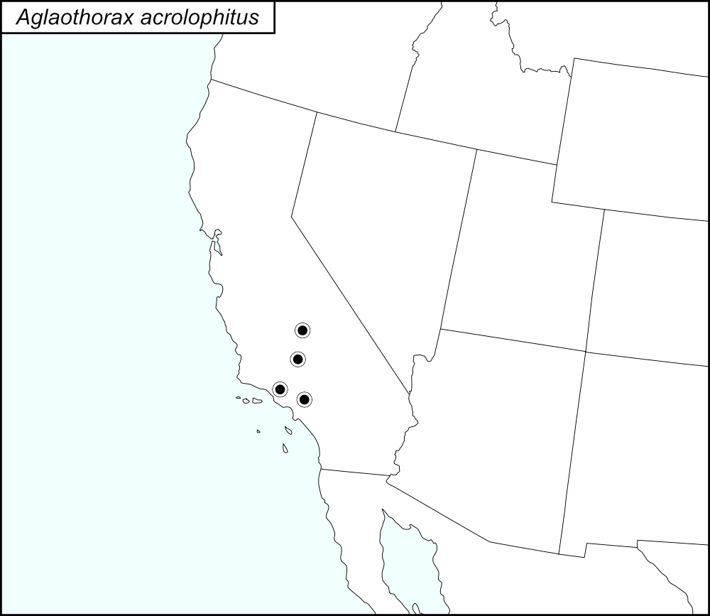

The black dots  on the distribution map represent county records.
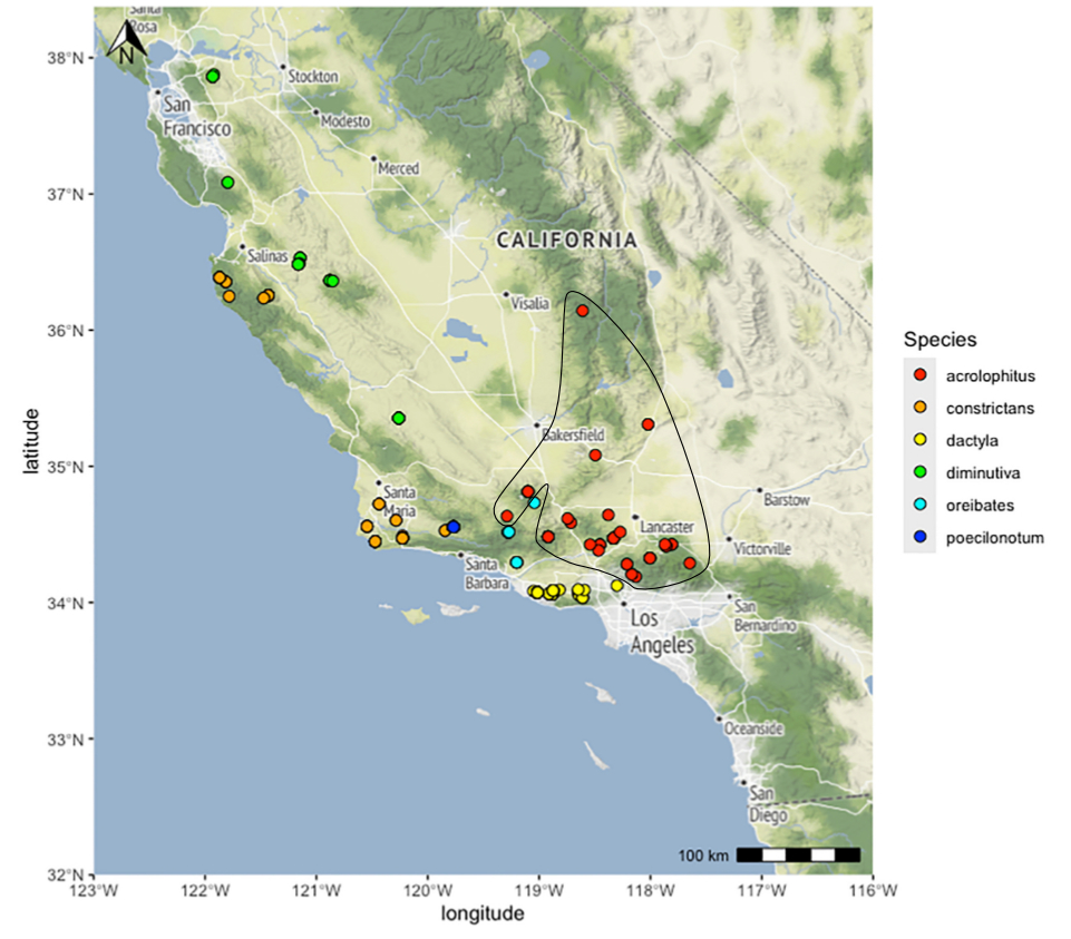
The above map shows the localities for the Diminutiva Group species from Cole et al. (2025). Red dots (enclosed in a black line*) show localities for A. acrolophitus.
State: California
Kern County:
Tehachapi, Water Canyon Road, 0.15 miles south of the intersection with Highland.
Tehachapi, Water Canyon Rd., 0.15 miles south of the intersection with Highline Rd.
Water Canyon Road, 1.4 miles below the entrance to Tehachapi Mountain Park.
Los Angeles County: Agua Dulce Canyon, Agua Dulce Canyon Road, 2 miles south of Agua dulce.
Arroyo Seco, Gabrielino Recreation Trail, end of Windsor.
Chilao Campground, Angeles National Forest, 25 miles northeast of La Canada Flintridge on SR2 (Angeles Crest Highway).
Devil’s Punchbowl County Park.
End of Stonehill Way, Canyon Country.
Forest Road 7N01 and San Francisquito Canyon Road.
Placerita Nature Center.
Templin Highway off I-5.
Clear Creek, San Gabriel Mountains.
County Road N4, 3 miles east of Big Rock Springs.
Altadena.
Bouquet Canyon.
Juniper Hills, Devil’s Punchbowl Road (County Road N6), 2 miles east of Longview Road.
San Gabriel Mountains, Big Tujunga Canyon near Fusier Canyon.
Sierra Highway, 0.5 miles west of Boiling Point.
Tulare County: Sierra Nevada, Sequoia National Forest, Greenhorn Mountains, Camp Nelson.
Ventura County: McGill Campground, Los Padres National Forest.
Squaw Flat Road at the trailhead to Sespe Creek, 8 miles north of Fillmore on Goodenough Road.
Pine Mountain Summit.
*Line encircling the locality dots was added to the map by the SINA editor (tmy) to help the viewer pick out the dots; this is not an indication of range or distribution.
Summary of Species' SINA Distribution*
Aglaothorax acrolophitus is found in the Western Transverse Ranges of California, from the San Emigdio Mountains in the west to the Tecachapi Mountains in the east and north into the southern Sierra Nevada.
*North America, north of Mexico.
List of United States Regions, States, and Counties
Map of
United States
Regions
Map of United States Regions
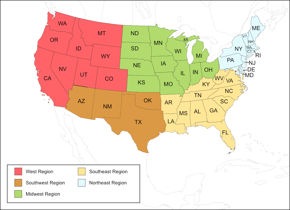
West Region
State: California
Counties: Kern, Los Angeles, Tulare, Ventura.
Notes
References:
The distribution map on this page is referred to as the 2024 distribution map.
All records are from Cole et al. (2025). [tmy 11 January 2026]