

constricted shieldback
Aglaothorax constrictans
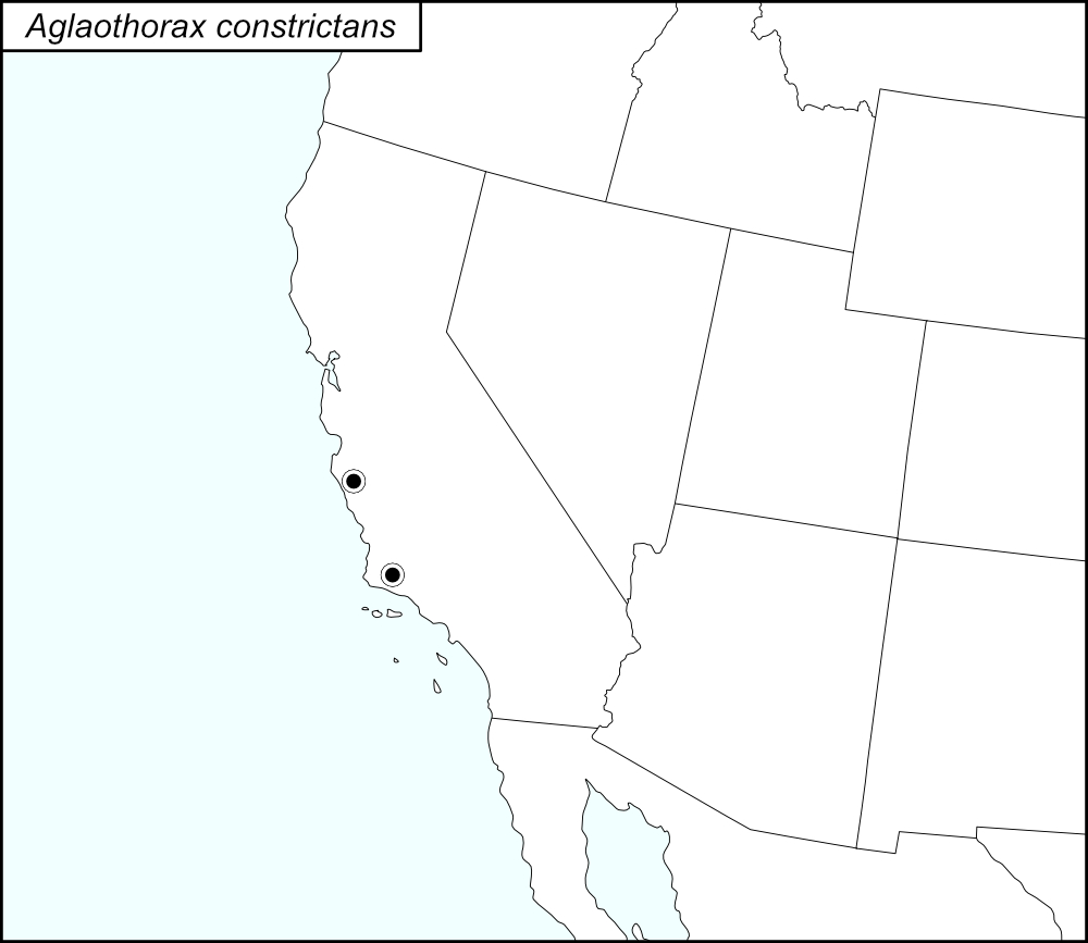

The black dots  on the distribution map represent county records.
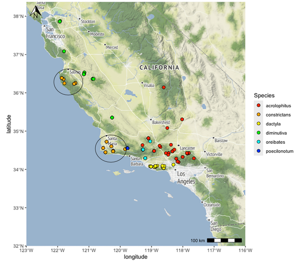
The above map shows the localities for the Diminutiva Group species from Cole et al. (2025). The orange dots (two populations, each encircled in a black line*) show localities for A. constrictans.
State: California
Monterey County: 0.9 miles east of Arroyo Seco and G17, intersection on Arroyo Seco.
Arroyo Seco Road, 0.6 miles west of intersection with G6.
Big Sur, SR1.
Bottcher’s Gap, Los Padres National Forest, 19 miles north of Big Sur off SR1 on Palo Colorado Road.
Palo Colorado Rd., 3 miles east of SR1.
Pfeiffer Big Sur State Park.
Santa Barbara County:Point Conception, Bixby Ranch, dunes near the Lighthouse.
Gaviota Pass Rest Area.
Gaviota State Park.
Harris Grade Road, 5 miles north of Lompoc.
Junction of Santa Rosa Road and US101.
Santa Ynez Mountains, 0.8 miles west of Cold Arch Bridge on Highway 154.
Vandenberg Air Force Base, 2.7 miles northwest of intersection 13th and Airfield on 13th.
*Lines encircling the locality dots were added to the map by the SINA editor (tmy) to help the viewer pick out the dots; this is not an indication of range or distribution.
Summary of Species' SINA Distribution*
Aglaothorax constrictans is found along the South Coast Ranges of California bordering the Pacific Ocean, from Point Conception north through the Santa Lucia Range.
*North America, north of Mexico.
List of United States Regions, States, and Counties
Map of
United States
Regions
Map of United States Regions
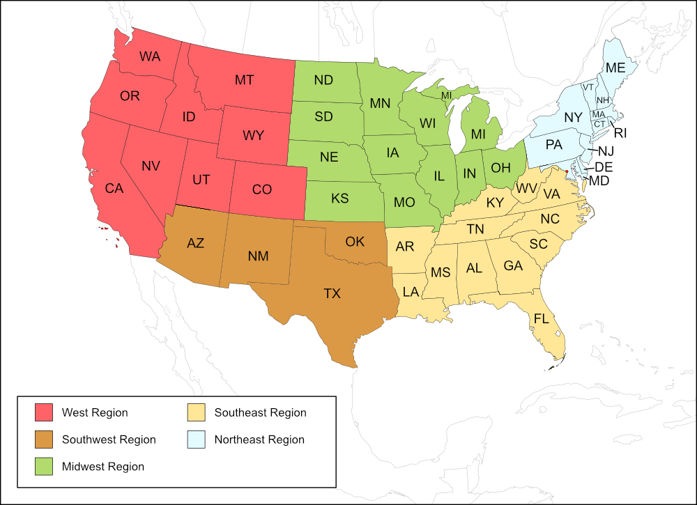
West Region
State: California
Counties: Monterey, Santa Barbara.
Notes
References:
The distribution map on this page is referred to as the 2024 distribution map.
All records are from Cole et al. (2025). [tmy 11 January 2026]