

forest home shieldback
Aglaothorax hulodomus
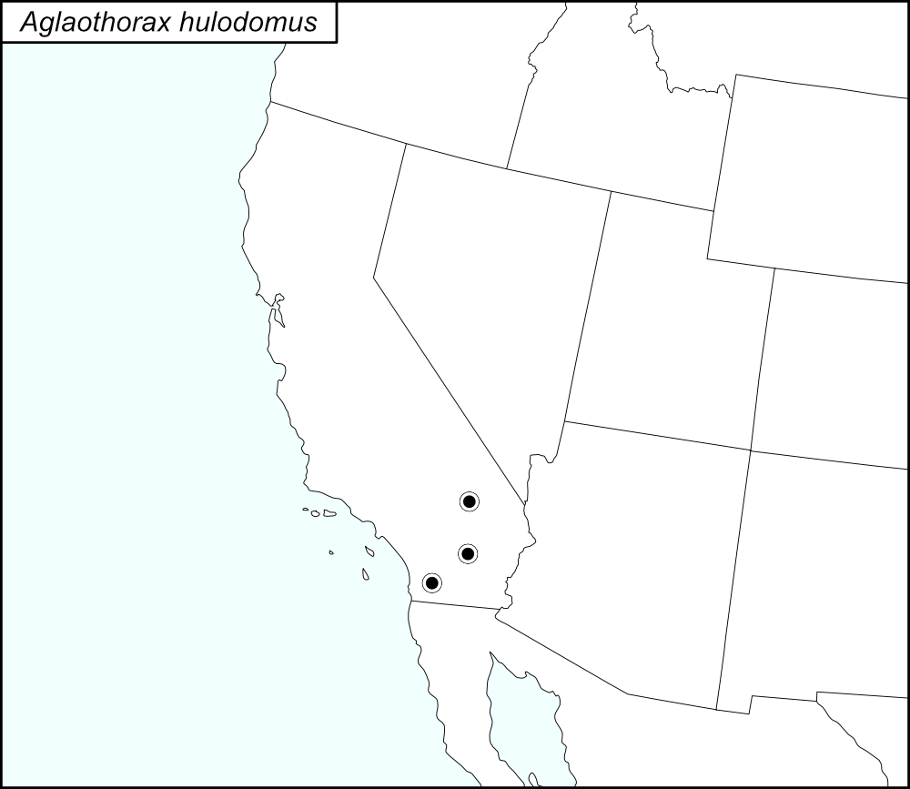

The black dots  on the distribution map represent county records.
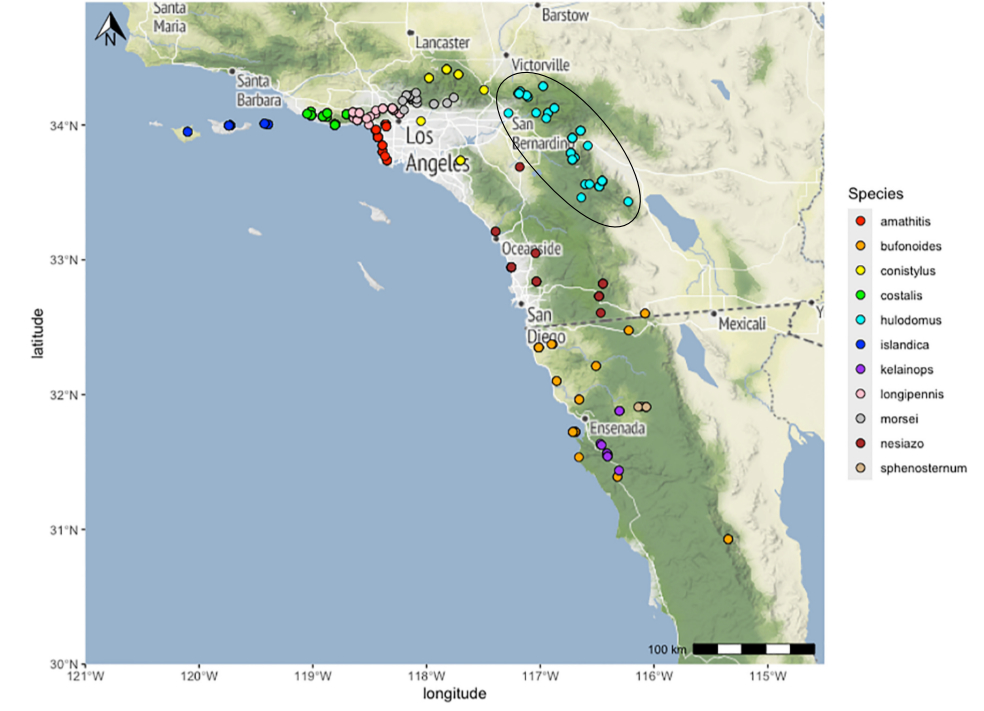
The above map shows the localities for the Morsei Group species from Cole et al. (2025). The light blue dots (encircled in a black line*) show localities for A. hulodomus.
State: California
Riverside County:
Cactus Spring Trailhead, 0.4 miles south of SR74 on Pinyon Flats Sta. Road.
Chino Canyon, 1.5-3.5 miles southwest of SR111, San Jacinto Mountains.
Fern Valley, Idyllwild.
Marion Canyon Campground, San Bernardino National Forest.
Pinyon Flat Campground, 14 miles southwest of Palm desert on SR74.
San Jacinto Mountains, 0.5 kilometers north of Idyllwild on Highway 243.
San Jacinto Mountains, 11.3 miles north of Idyllwild on Highway 243.
Santa Rosa Mountains.
SR371 east of Anza.
SR74 roadside through Santa Rosa Indian Reservation.
Whitewater Canyon, 3 miles north of Highway 10 on Whitewater Canyon Road.
Whitewater Canyon.
Garnet Queen Creek at Santa Rosa Mountain Truck Trail.
San Bernardino County:
San Bernardino Mountains, State Highway 18, 0.7 mile west and east of Skyforest.
0.4 miles west of Skyforest at Switzer Park Picnic Grounds.
Camp O-ongo, near Running Springs.
San Bernardino Mountains, Camp O-Ongo, 2.5 miles northwest of Running Springs.
Forest Home, Mill Creek.
Hanna Flat Campground, San Bernardino National Forest.
Mill Creek.
Oak Glen beyond Penyoct Flat.
San Bernardino Mountains, 0.8 miles east of Lake Arrowhead (City) on Highway 173.
San Bernardino Mountains.
San Bernardino Mountains, Mill Creek Road.
San Bernardino.
Switzer Picnic Area, San Bernardino National Forest.
Heaps Peak Arboretum.
San Diego County:
Mariposa Ranch, Anza.
*Line encircling the locality dots was added to the map by the SINA editor (tmy) to help the viewer pick out the dots; this is not an indication of range or distribution.
Summary of Species' SINA Distribution*
Aglaothorax hulodomus is found in Transverse and Peninsular Ranges of California, including the San Bernardino, San Jacinto, and Santa Rosa Mountains.
*North America, north of Mexico.
List of United States Regions, States, and Counties
Map of
United States
Regions
Map of United States Regions
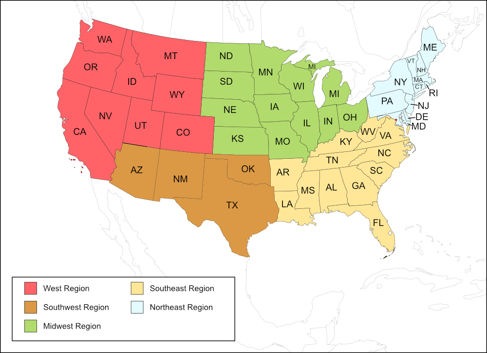
West Region
State: California
Counties: Riverside, San Bernardino, San Diego.
Notes
References:
The distribution map on this page is referred to as the 2024 distribution map.
All records are from Cole et al. (2025). [tmy 11 January 2026]